
Last modified: 2012-12-29 by ian macdonald
Keywords: sao paulo | luís antônio |
Links: FOTW homepage |
search |
disclaimer and copyright |
write us |
mirrors
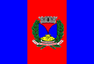 image by Ivan Sache, 16 December 2012
Source:
http://portal.cnm.org.br/sites/7800/7818/turismoSP/luiz_antonio/bandeira.jpg
A vertical triband, blue-red-blue, with the municipal arms in the centre.
The official website is at
http://www.connectatecno.com.br/pmla/index.php.
Dirk Schönberger,
4 December 2012
The municipality of Luíz Antônio (11,286 inhabitants in 2010; 59,844 ha) is located 275 km of São Paulo. Luíz Antônio was founded, according to the tradition, on 13 December 1892 by the traveller Carlos Loyola, from São Simão; transporting coffee to the port of Jataí, Loyola suddenly became blind. He asked for help St. Lucia, whose day is the 13th of December; as expected, he was cured and rewarded the saint by establishing a "botica", a kind of pharmacy where he sold drugs to the locals and to the travellers. The pharmacy was subsequently transformed into a bigger shop where food and tools were sold. Originally known as Vila Jataí, the settlement that developed around the shop was renamed Luíz Antônio when established as a district of the municipality of São Simão on 8 October 1937 by Law No. 3,102. The new name of the settlement is a tribute to Colonel Luíz Antônio Junqueira, who owned an estate in the region and promoted its development. The municipality of Luíz Antônio was established on 18 February 1959 by State Law no. 5,285 and inaugurated on 1 January 1960.
The flag of Luíz Antônio is vertically divided blue-red-blue, with the red stripe broader than the blue stripes and the municipal coat of arms placed in the middle.
Photo of the flag:
http://www.connectatecno.com.br/pmla/uploads/galeria/Dia-das-Criancas---2011/4e7624d3e5437bbe65e40d13c7b65468.jpg