
This page is part of © FOTW Flags Of The World website
Opsterland (The Netherlands)
Fryslân province
Last modified: 2018-12-15 by rob raeside
Keywords: opsterland |
Links: FOTW homepage |
search |
disclaimer and copyright |
write us |
mirrors
 Shipmate Flagchart : http://www.flagchart.net
adopted 10 Apr 1963
Other Opsterlân pages:
See also:
Opsterland municipality
Number of inhabitants (1 Jan 2003): 29.012; area: 227,56 km². Settlements:
Beetsterzwaag (seat), Bakkeveen, Frieschepalen,
Gorredijk,
Hemrik,
Jonkerslân, Langezwaag, Lippenhuizen, Luxwoude,
Nij Beets, Olterterp, Siegerswoude, Terwispel, Tijnje, Ureterp, Wijnjewoude.
Opsterland/Opsterlân is a municipality in southeast Friesland
between the important regional centers of Drachten and Heerenveen. It is
a woody region.
The flag was adopted 10 Apr 1963, but was taken in use in 1957; the
colors are derived from the municipal Coat of Arms.
Jarig bakker, 1 September 1999
Opsterland Coat of Arms
![[Opsterland Coat of Arms]](../images/n/nl-fr)op.jpg) from the Opsterland municipal
website.
from the Opsterland municipal
website.
Granted 25 Mar 1818.
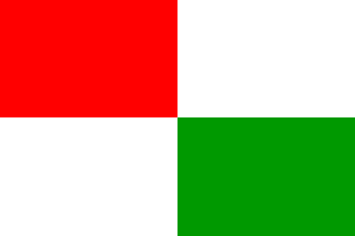
Gorredijk village (de Gordyk)
![[Gorredijk village flag]](../images/n/nl-fr_gd.gif) Shipmate Flagchart : http://www.flagchart.net
Shipmate Flagchart : http://www.flagchart.net
Adopted 1998
Hemrik village
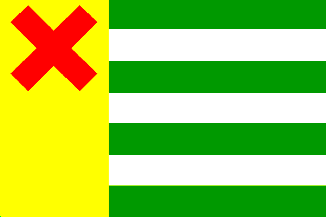 Shipmate Flagchart : http://www.flagchart.net
Lúkswâld village (Luxwoude)
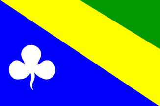 Shipmate Flagchart : http://www.flagchart.net